Botlink’s Imagery Tools
Selector Tool
Allows you to hover over any measurement or annotation on the map to narrow the list on the left to what is selected. Click on a measurement or annotation to edit.

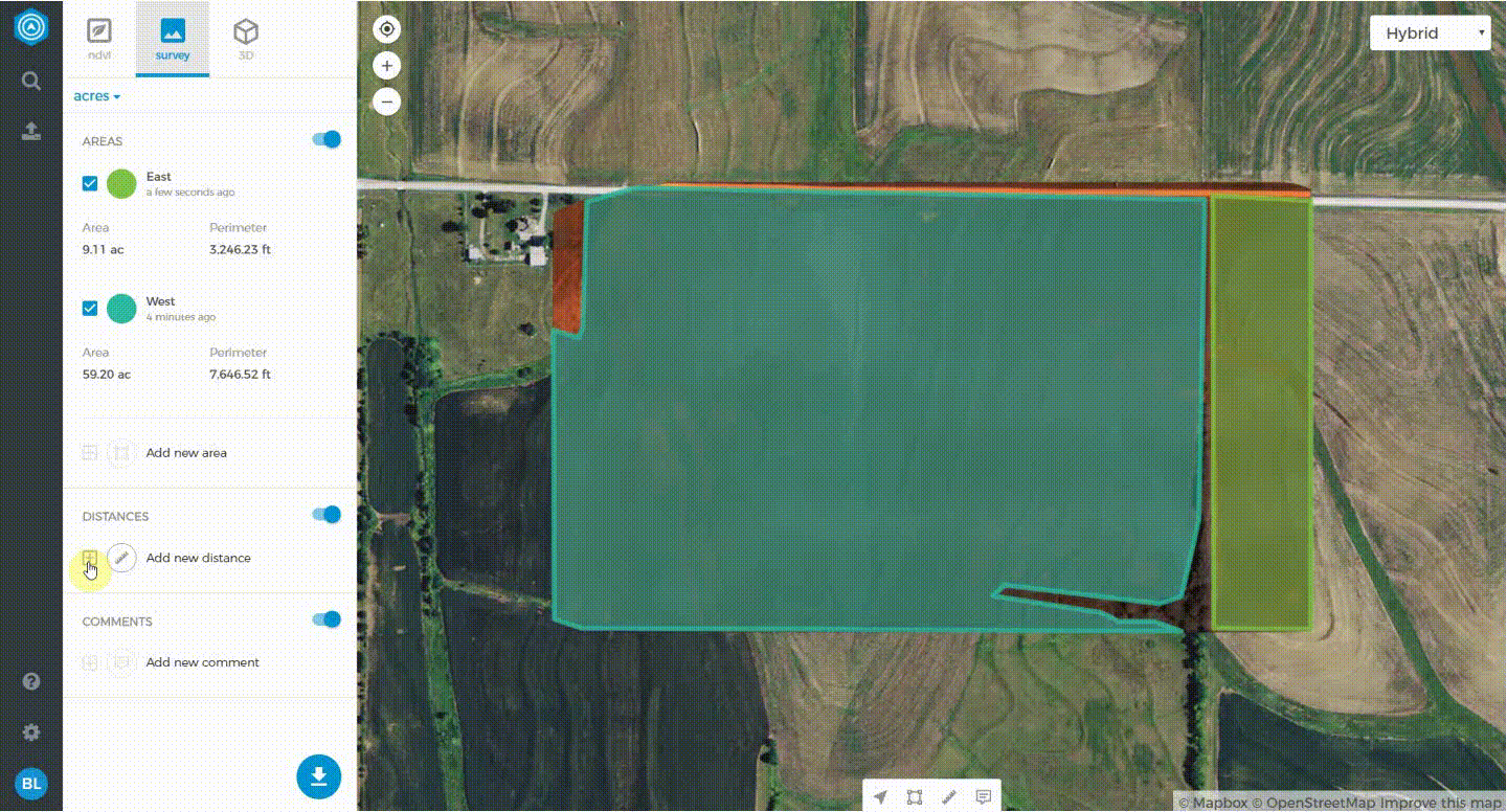
Area Measurement
Use this tool to take measurements of an area on your map. Select this tool, click to outline the area, and finish by clicking on the first point.

Linear measurement
Useful for measuring distances. Select this tool, click the beginning of your desired segment, and continue adding segments. Once finished select the end point twice to end the measurement.
Annotation
If you need to make a note about a location the Annotation tool is perfectly suited. Simply drop the pin on the map and click the edit button to write a description for that annotation.

For each measurement and annotation you create you can edit or delete them using the edit button and delete button that are in-line with their titles.