Mission Overview With Botlink
Missions are automated flight plans loaded into a drone for data gathering purposes. Botlink for MAVLink features two types of missions, Survey and Custom. For most purposes, the Survey Mission type is the preferred mission type. This article will outline the basic features of Botlink missions.
Missions Page
The Missions Page can be used to manage, edit, and plan new flights. The Missions page can accessed using the Menu button and selecting Missions. Saved Missions can be found on this page with a satellite preview of the flight area, size of flight plan area, and date created. Tap the mission to preview flight plan and make edits. Use the Add button to create new Survey and Custom Missions.
Survey Missions
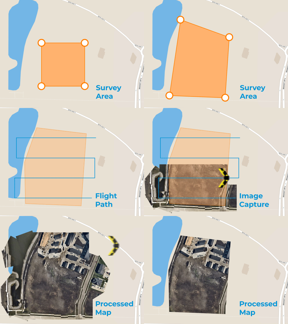
Survey Missions are used to map a specified area using a automated flight plan. Botlink automatically determines the flight path required to sufficiently capture the Survey Area. The drone will fly back and forth across the Survey Area similar to a lawnmower pattern. Once images have been captured, they can be processed and stitched together using the Botlink Web app.
Custom Missions
Custom Missions allow for multiple way-points and survey missions within a single mission. The Custom Mission tool is helpful if you have multiple small areas of interest that you can in a single battery charge.
Pre-flight
Entering Preflight takes your flight plan and applies specific mission settings. These settings include Wind Direction, and Takeoff/Landing Settings. Setting the wind direction will prompt proper flight alignment into the wind. Every takeoff and landing should be conducted with the nose of the airplane into the wind. Survey missions should be conducted with aircraft nose perpendicular to the wind.


