InSites Flight Types
Flight Types for Upload
Botlink InSites offers a couple of different map upload - NDVI, Survey, and 3D - and in this article we’ll explain the purpose of each map.
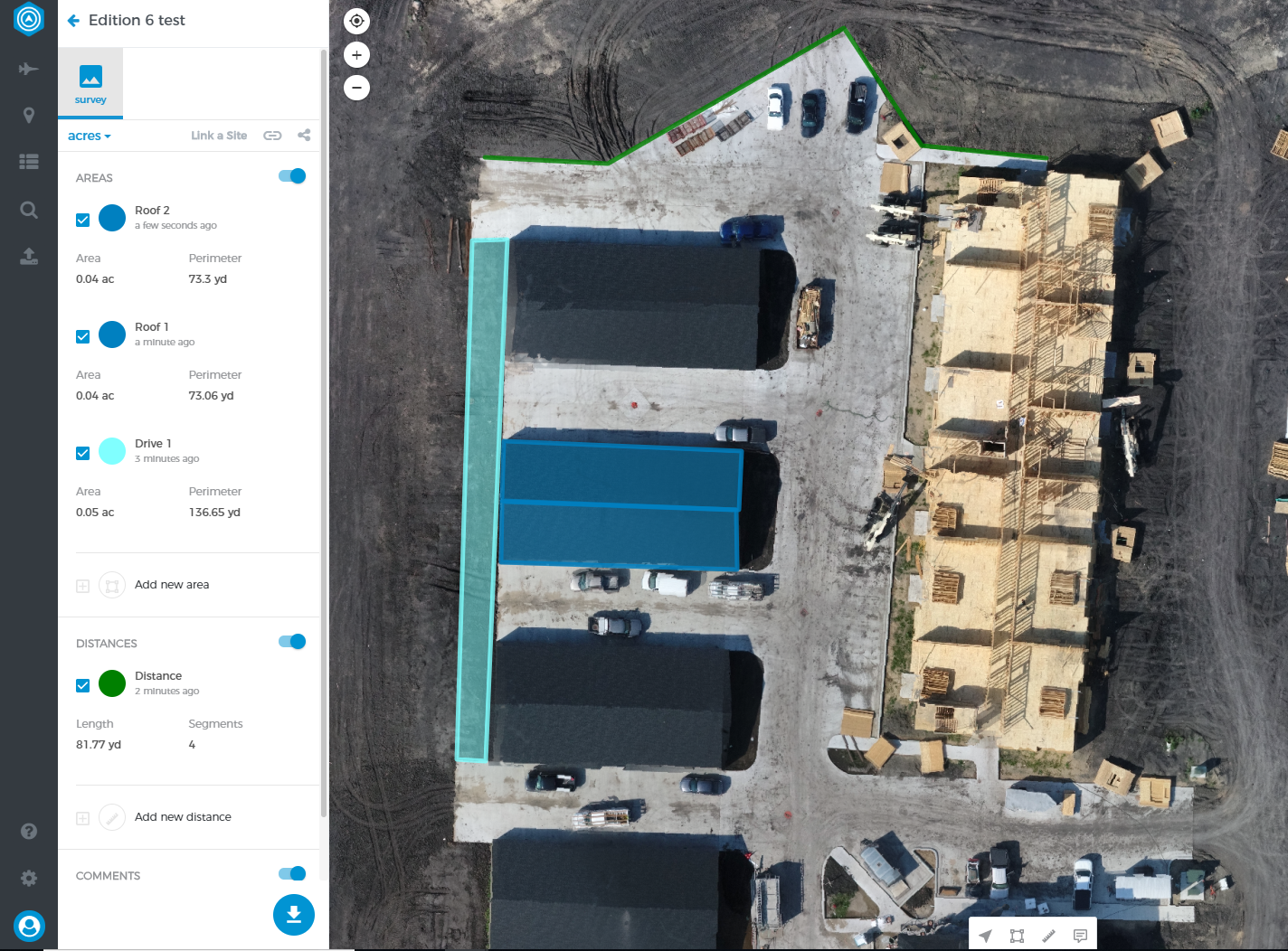
Survey Map
Survey maps are ideal for anyone who just wants a complete, stitched map, but doesn’t need the volumetric information. Common use cases for survey maps are people monitoring construction sites, scouting farmland, or inspecting roofs for damage.
While survey maps are limited in the amount of 3D information generated, one of the big advantages of uploading a survey map is the increased speed in processing.
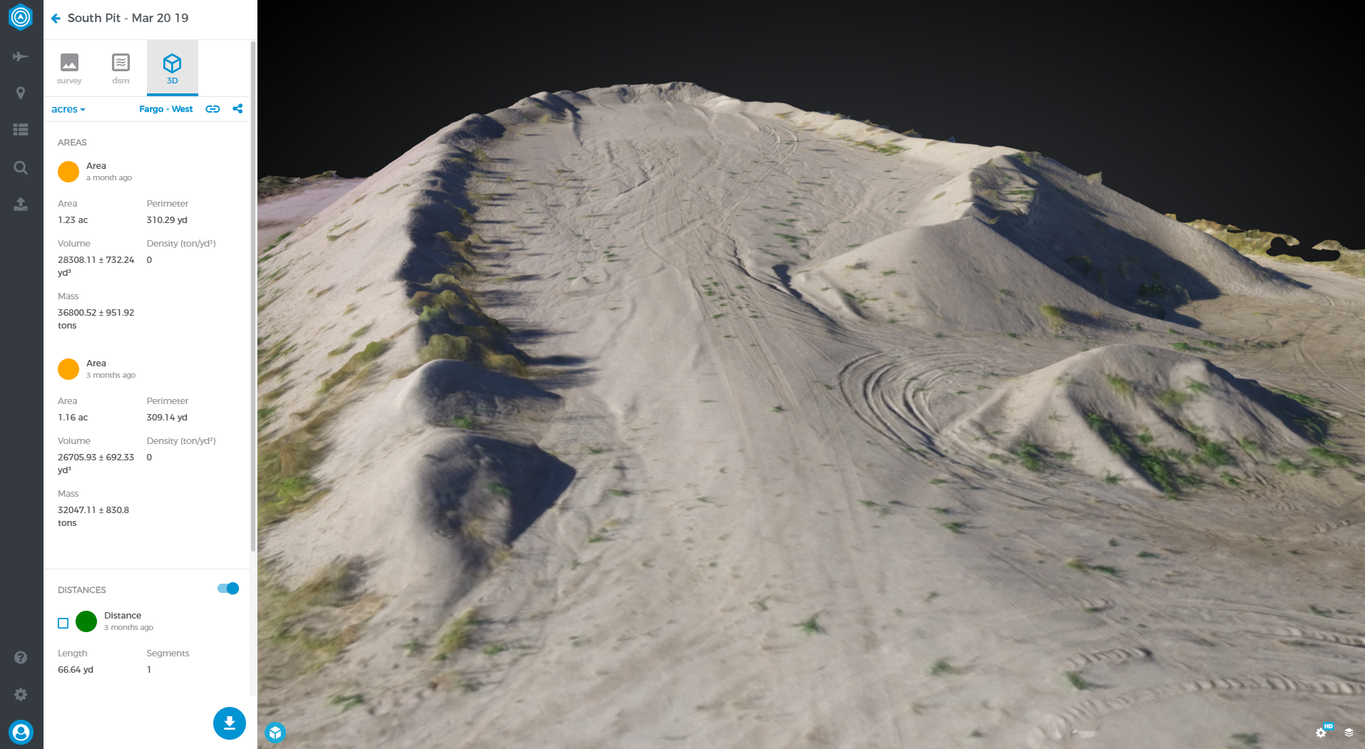
3D Model
The 3D Model map type is the most commonly used map type in Botlink InSites, and the reasoning is pretty simple - this map type creates the most actionable data. A large majority of maps created with InSites are in the aggregate industry, and being able to determine tonnage of sand or gravel on the ground requires a 3D model.
While most of the data created with 3D models is accessed in the survey view, this map type also creates a full 3D model that is useful as well. One thing to note about 3D models; because of the complexity of the map, it does take a little longer than our standard survey map, but it’s well worth the wait.
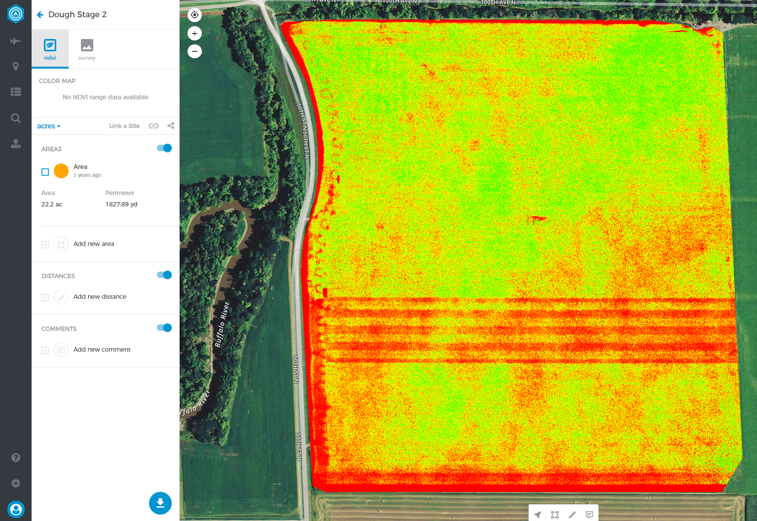
Vegetation Index
The vegetation index map type is designed for those who are flying agriculture fields. It’s important to note that this map type requires images captured with a NDVI camera, such as the sensors from Sentera.
Basically images captured with a NDVI camera/sensor filter light in such a way that it allows us to see plant health with the naked-eye. This is an excellent tool for anyone looking to quickly diagnose problem areas, and then be able to apply a fix in a very targeted way.